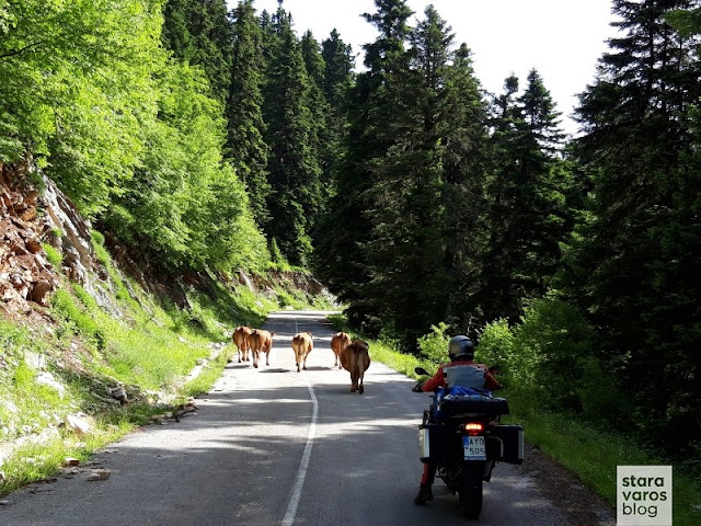
Among my motorcyclist friends, the conditions that ensure a successful trip are often discussed. Many support the idea that the evaluation o...

Among my motorcyclist friends, the conditions that ensure a successful trip are often discussed. Many support the idea that the evaluation of a trip is mainly determined by the record-breaking coverage of infinite kilometers per day, by how "exotic" the destination was, how many finally managed to get there and various other factors that, in the end, may not even be required for a motorcycle ride. 
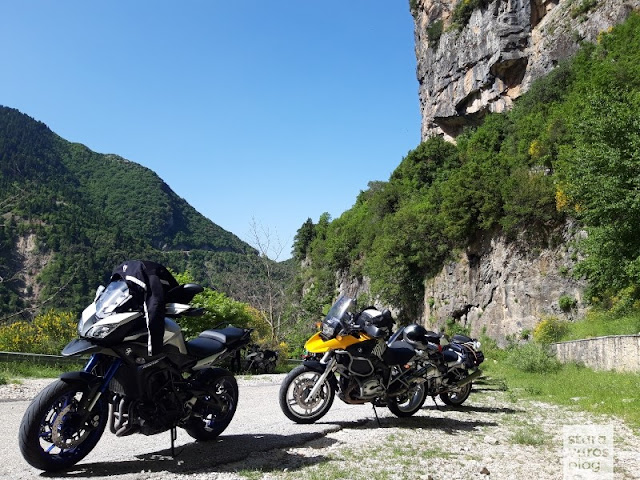
On the contrary, to see something new and beautiful, to get lost in forgotten and abandoned country roads, to get close to nature and (re)discover your true self, most of the times you do not even need to fend off far from home. The exploration of the largest mountain range in Greece, the Pindos, verifies all the above.

Stara Varos Blog - Exploration of the Pindus mountain range: Tzoumerka and the Baros Pass

Dominating almost all of western Greece, the endless complex of mountains, peaks, plateaus, valleys and gorges has a length of up to 230 km and a maximum width of 70 km. The imposing mountain mass is the backbone of Greece, as it begins near the borders with Albania, keeps going south to the Peloponnese in the Corinthian Gulf and, after finally emerging in Crete, is rightly considered the southern end of the Dinaric Alps. The most important mountains that make up the Pindos mountain range are the Athamanika Mountains (Tzoumerka), Grammos, Tymfi (Gamila), Agrafa, Lakmos (Peristeri) and others, while Smolikas has its highest peak, at 2,637 meters.  
Photos and brief comments from a short ride in the Athamanika Mountains and the Baros Pass, follow right bellow.

Stara Varos Blog - Exploration of the Pindus mountain range: Tzoumerka and the Baros Pass

An appointment with friends was given to Melissourgoi (a village in the prefecture of Arta, that is built at an altitude of 850 - 870 meters, on the slopes of the Tzoumerka Mountains).

Stara Varos Blog - Exploration of the Pindus mountain range: Tzoumerka and the Baros Pass

Stara Varos Blog - Exploration of the Pindus mountain range: Tzoumerka and the Baros Pass

From a wide range of options for accommodation in the area, i singled out the remarkable Melissourgoi Mountain Refuge.

Stara Varos Blog - Exploration of the Pindus mountain range: Tzoumerka and the Baros Pass

Stara Varos Blog - Exploration of the Pindus mountain range: Tzoumerka and the Baros Pass

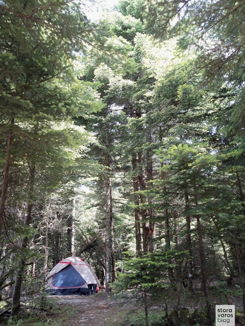
I camped a bit out of the refuge's bounds, to try my tent and myself, since i would soon be on a multi-day trip to Italy - Austria with the same equipment setup and the mood for wild camping. [About that trip: A taste of the Alps].

Stara Varos Blog - Exploration of the Pindus mountain range: Tzoumerka and the Baros Pass

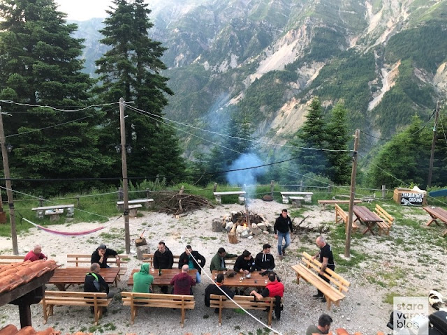
Meeting with friends at the refuge.

Stara Varos Blog - Exploration of the Pindus mountain range: Tzoumerka and the Baros Pass

Stara Varos Blog - Exploration of the Pindus mountain range: Tzoumerka and the Baros Pass

Kalimera Tzoumerka!

Stara Varos Blog - Exploration of the Pindus mountain range: Tzoumerka and the Baros Pass

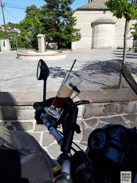
But first, a stop in the village of Pramanta for a coffee for the road (*note: i must not forget to return the glass).

Stara Varos Blog - Exploration of the Pindus mountain range: Tzoumerka and the Baros Pass

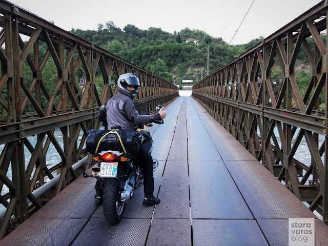
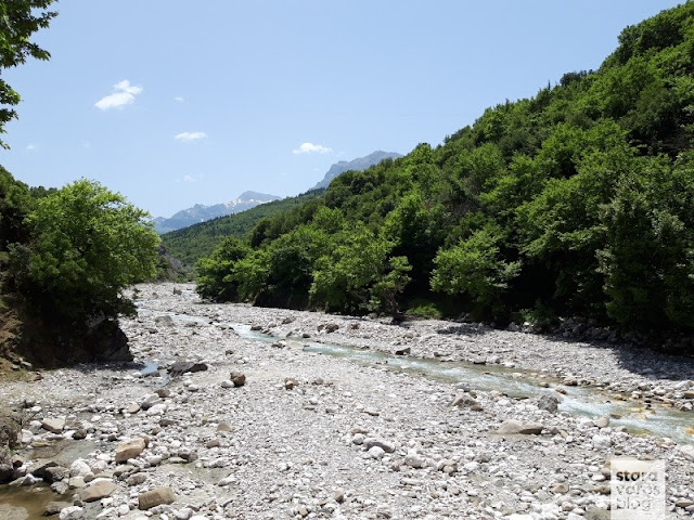
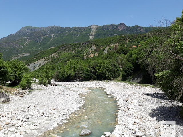
Crossing the Kalaritikos river.

Stara Varos Blog - Exploration of the Pindus mountain range: Tzoumerka and the Baros Pass

Stara Varos Blog - Exploration of the Pindus mountain range: Tzoumerka and the Baros Pass

This was followed by a visit to the monastery of Kipina.

Stara Varos Blog - Exploration of the Pindus mountain range: Tzoumerka and the Baros Pass

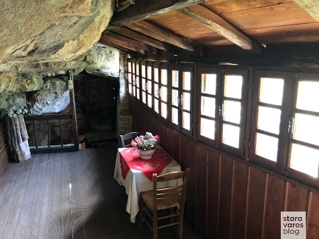
The monastery is built in a large cave of a vertical rock and its foundation, according to its founding inscription, is attributed to the year 1349, while according to Seraphim Byzantios, Metropolitan of Arta and historian, it is even older.

Stara Varos Blog - Exploration of the Pindus mountain range: Tzoumerka and the Baros Pass

The access to the monastery is a path carved into the rock, but in the old days it was interrupted by a mobile wooden bridge - the lysia (λυσιά) - which was removed at night or in an emergency.

Stara Varos Blog - Exploration of the Pindus mountain range: Tzoumerka and the Baros Pass

The location and nature of the monument, the crypt on the ground floor, the 240 m long cave, which opens on the north side of the narthex, the adjacent loopholes and the limited access to it, make the monastery inaccessible and one of the few that were not destroyed by looting raids.

Stara Varos Blog - Exploration of the Pindus mountain range: Tzoumerka and the Baros Pass

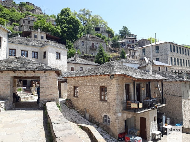
View to the village Syrrako, perhaps one of the most beautiful villages of Pindos.

Stara Varos Blog - Exploration of the Pindus mountain range: Tzoumerka and the Baros Pass

Stara Varos Blog - Exploration of the Pindus mountain range: Tzoumerka and the Baros Pass

Coffee and rest in the main square of Syrrako village.

Stara Varos Blog - Exploration of the Pindus mountain range: Tzoumerka and the Baros Pass

Stara Varos Blog - Exploration of the Pindus mountain range: Tzoumerka and the Baros Pass

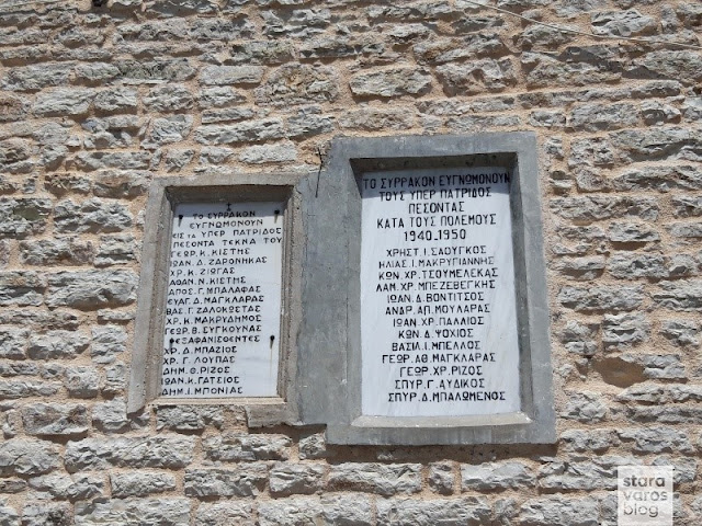
It is worthwhile to deal with the history of the village, since this one did not escape the common fate of the other Tzoumerka villages, which during World War II (especially from the middle to the end of October 1943) suffered great damage from the purges of the German occupiers. Tribute to the fallen for the homeland.

Stara Varos Blog - Exploration of the Pindus mountain range: Tzoumerka and the Baros Pass

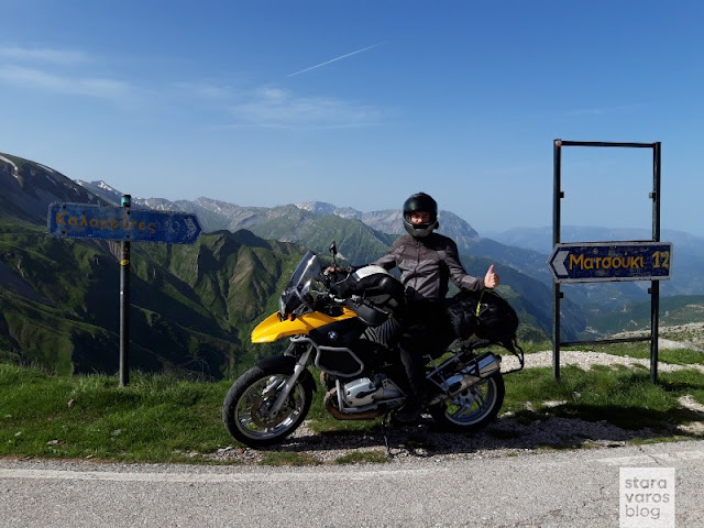
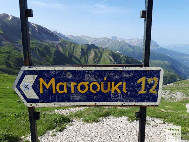
Relatively close, just a stone's throw northeast of Kalarrites village and where the mountains Peristeri and Kakarditsa meet, is located the highlight of the area, the Baros Pass or, by analogy with the names of the alpine passages, the Passo Baros.

Stara Varos Blog - Exploration of the Pindus mountain range: Tzoumerka and the Baros Pass

Stara Varos Blog - Exploration of the Pindus mountain range: Tzoumerka and the Baros Pass

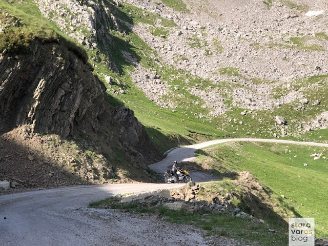
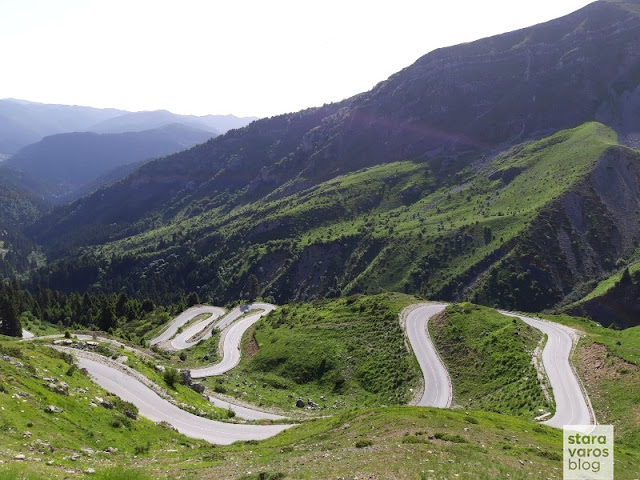
At 1905 meters, it is one of the three passages that connect Thessaly with Epirus region. It is likely to be the highest altitude asphalt road in the country, while it is worth mentioning that until 1912 and the Wars for Independence, it delimited the Greek-Ottoman empire border.

Stara Varos Blog - Exploration of the Pindus mountain range: Tzoumerka and the Baros Pass

Stara Varos Blog - Exploration of the Pindus mountain range: Tzoumerka and the Baros Pass

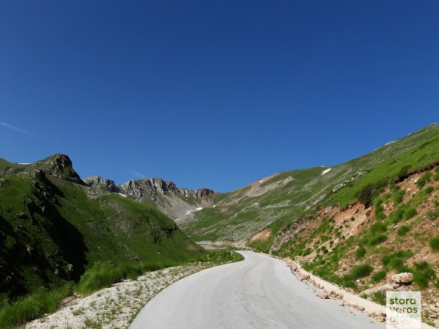
Descending, i came across the section of the passage that opens in late spring and of course, very often even then, strong weather phenomena prevail, such as strong winds and snowfall.

Stara Varos Blog - Exploration of the Pindus mountain range: Tzoumerka and the Baros Pass

Stara Varos Blog - Exploration of the Pindus mountain range: Tzoumerka and the Baros Pass

Stara Varos Blog - Exploration of the Pindus mountain range: Tzoumerka and the Baros Pass

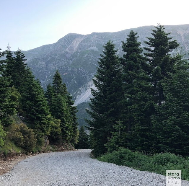
Just before Chaliki, near the Acheloos river and the junction to Aspropotamos (Municipality of Kalampaka), the vegetation was so dense that in no way it could be compared to the barren and stony landscape i left behind before Baros Pass.

Stara Varos Blog - Exploration of the Pindus mountain range: Tzoumerka and the Baros Pass

Direction to Anilio (Metsovo) and return to Thessaloniki via Egnatia Odos motorway.
As already mentioned in the introduction, the Pindos mountain range while being accessible from any part of the country, is still an area of infinite natural beauty that calls you to discover it, making it an ideal destination for motorcycle ride getaways.

Σε συζητήσεις φίλων μοτοσικλετιστών, διερευνώνται συχνά οι όροι που εξασφαλίζουν μια πετυχημένη εκδρομή και μεταξύ αυτών η κάλυψη άπειρων χι...

Σε συζητήσεις φίλων μοτοσικλετιστών, διερευνώνται συχνά οι όροι που εξασφαλίζουν μια πετυχημένη εκδρομή και μεταξύ αυτών η κάλυψη άπειρων χιλιομέτρων ανά ημέρα. Επιπρόσθετα, αρκετοί υποστηρίζουν πως η τελική αποτίμηση ενός ταξιδιού προσδιορίζεται κυρίως από το πόσο «εξωτικός» είναι ο προορισμός, από το πόσο λίγοι κατάφεραν να βρεθούν εκεί και διάφορα άλλα που, ίσως τελικά, δεν είναι καν το ζητούμενο σε μια βόλτα. 
Αντιθέτως, για να δεις κάτι καινούργιο, για να χαθείς σε όμορφες διαδρομές, για να έρθεις κοντά στη φύση και να ανακαλύψεις (ξανά) τον πραγματικό σου εαυτό, πολλές φορές δε χρειάζεται καν να ταξιδέψεις μακριά από το σπίτι σου. Η εξερεύνηση της ευρύτερης περιοχής της μεγαλύτερης οροσειράς της Ελλάδας, της Πίνδου, επαληθεύει τα ανωτέρω.

Οροσειρά Πίνδου: Τζουμέρκα και πέρασμα Μπάρου

Κυριαρχώντας σχεδόν σε ολόκληρη την δυτική Ελλάδα, το ατελείωτο σύμπλεγμα βουνών, κορυφών, υψιπέδων, κοιλάδων και φαραγγιών έχει μήκος που αγγίζει τα 230 χιλιόμετρα και ανώτερο πλάτος 70 χιλιόμετρα. Ουσιαστικά, ο επιβλητικός ορεινός όγκος αποτελεί τη ραχοκοκαλιά της Ελλάδας, καθώς ξεκινά κοντά στα σύνορα με την Αλβανία, συνεχίζει νότια μέχρι την Πελοπόννησο στον Κορινθιακό κόλπο και αφού τελικά αναδύεται στην Κρήτη, δικαιολογημένα θεωρείται η νότια απόληξη των Άλπεων. Τα σημαντικότερα βουνά που αποτελούν την οροσειρά της Πίνδου είναι τα Αθαμανικά Όρη (Τζουμέρκα), ο Γράμμος, η Τύμφη (Γκαμήλα), τα Άγραφα, ο Λάκμος (Περιστέρι) και άλλα, ενώ στον Σμόλικα ανήκει η ψηλότερη κορυφή της, στα 2.637 μέτρα.  
Ακολουθούν φωτογραφίες και σύντομα σχόλια από μια βόλτα στα Αθαμανικά Όρη και το πέρασμα Μπάρου.

Οροσειρά Πίνδου: Τζουμέρκα και πέρασμα Μπάρου

Ραντεβού με φίλους δόθηκε στους Μελισσουργούς, χωριό του νομού Άρτας χτισμένο σε υψόμετρο 850 - 870 μέτρα, στις πλαγιές των Τζουμέρκων.

Οροσειρά Πίνδου: Τζουμέρκα και πέρασμα Μπάρου

Οροσειρά Πίνδου: Τζουμέρκα και πέρασμα Μπάρου

Υπάρχει μεγάλο εύρος επιλογών για τη διαμονή στην περιοχή, ξεχωρίζω όμως το αξιόλογο ορεινό καταφύγιο Μελισσουργών.

Οροσειρά Πίνδου: Τζουμέρκα και πέρασμα Μπάρου

Οροσειρά Πίνδου: Τζουμέρκα και πέρασμα Μπάρου

Έστησα την σκηνή μου ελαφρώς εκτός ορίων, για να δοκιμάσω αυτή αλλά και τον εαυτό μου, μιας και σύντομα θα βρισκόμουν σε πολυήμερη εκδρομή στην Ιταλία – Αυστρία με το ίδιο σετάρισμα στον εξοπλισμό αλλά και τη διάθεση για κατασκήνωση. [Σχετικά με την εκδρομή μου: Μια γεύση από Άλπεις].

Οροσειρά Πίνδου: Τζουμέρκα και πέρασμα Μπάρου

Συνάντηση με φίλους στο καταφύγιο.

Οροσειρά Πίνδου: Τζουμέρκα και πέρασμα Μπάρου

Οροσειρά Πίνδου: Τζουμέρκα και πέρασμα Μπάρου

Καλημέρα Τζουμέρκα!

Οροσειρά Πίνδου: Τζουμέρκα και πέρασμα Μπάρου

Πρώτα όμως μια στάση στο χωριό Πράμαντα για ένα καφεδάκι για το δρόμο.

Οροσειρά Πίνδου: Τζουμέρκα και πέρασμα Μπάρου

Πέρασμα από τον Καλαρυτικό ποταμό.

Οροσειρά Πίνδου: Τζουμέρκα και πέρασμα Μπάρου

Οροσειρά Πίνδου: Τζουμέρκα και πέρασμα Μπάρου

Ακολούθησε επίσκεψη στην Μονή της Κηπίνας, το άπαρτο καστρομονάστηρο.

Οροσειρά Πίνδου: Τζουμέρκα και πέρασμα Μπάρου

Η Μονή είναι κτισμένη μέσα σε μεγάλη σπηλιά ενός κάθετου βράχου και η ίδρυσή της, σύμφωνα με την κτητορική της επιγραφή, αποδίδεται το έτος 1349, ενώ σύμφωνα με τον Σεραφείμ Βυζάντιο, Μητροπολίτη Άρτας και ιστοριοδίφη, είναι ακόμα παλιότερη.

Οροσειρά Πίνδου: Τζουμέρκα και πέρασμα Μπάρου

Η προσπέλαση του μοναστηριού γίνεται από ένα μονοπάτι λαξεμένο στο βράχο, αλλά τα παλιά χρόνια η επικοινωνία διακοπτόταν από μια κινητή ξύλινη γέφυρα – τη λυσιά – η οποία αφαιρούνταν τη νύχτα ή σε περίπτωση κινδύνου, με τη σωζόμενη και σήμερα «μανιβέλα».

Οροσειρά Πίνδου: Τζουμέρκα και πέρασμα Μπάρου

Η θέση και η φύση του μνημείου, η κρύπτη του ισογείου, το μήκους 240 μ. σπήλαιο, που ανοίγεται στην βόρεια πλευρά του νάρθηκα, οι διπλανές πολεμίστρες και η περιορισμένη σε αυτό πρόσβαση, καθιστούν το μοναστήρι απροσπέλαστο και ένα από τα λίγα μοναστήρια που δεν καταστράφηκε από ληστρικές επιδρομές.

Οροσειρά Πίνδου: Τζουμέρκα και πέρασμα Μπάρου

Θέα προς το χωριό Συρράκο, ίσως ένα από τα ομορφότερα χωριά της Πίνδου.

Οροσειρά Πίνδου: Τζουμέρκα και πέρασμα Μπάρου

Οροσειρά Πίνδου: Τζουμέρκα και πέρασμα Μπάρου

Καφές και ξεκούραση στην κεντρική πλατεία.

Οροσειρά Πίνδου: Τζουμέρκα και πέρασμα Μπάρου

Οροσειρά Πίνδου: Τζουμέρκα και πέρασμα Μπάρου

Αξίζει να ασχοληθεί κανείς την ιστορία του χωρίου, μιας και αυτό δε γλίτωσε την κοινή μοίρα των Τζουμερκοχωρίων, που κατά τον  Β' Παγκόσμιο Πόλεμο (ειδικότερα από τα μέσα μέχρι το τέλος Οκτωβρίου του 1943) υπέστησαν μεγάλες καταστροφές από τις εκκαθαρίσεις των Γερμανών κατακτητών καταβάλλοντας τις εκεί ελληνικές αντιστασιακές δυνάμεις. Αφιερωματική πλάκα στους πεσόντες υπέρ της πατρίδος.

Οροσειρά Πίνδου: Τζουμέρκα και πέρασμα Μπάρου

Αρκετά κοντά βρίσκεται το highlight της περιοχής, ο αυχένας του Μπάρου, το πέρασμα του Μπάρου ή, κατ’ αναλογία των ονομάτων των αλπικών περασμάτων, το Passo Baros. Βρίσκεται βορειοανατολικά των Καλαρρύτων, εκεί που συναντιόνται τα όρη Περιστέρι και Κακαρδίτσα.

Οροσειρά Πίνδου: Τζουμέρκα και πέρασμα Μπάρου

Οροσειρά Πίνδου: Τζουμέρκα και πέρασμα Μπάρου

Στα 1905 μέτρα, αποτελεί ένα από τα τρία περάσματα που ενώνουν τη Θεσσαλία με την Ήπειρο. Πιθανό να πρόκειται για τον σε μεγαλύτερο υψόμετρο ασφαλτοστρωμένο δρόμο της χώρας, ενώ αξίζει να σημειωθεί πως μέχρι το 1912 οριοθετούσε τα ελληνοτουρκικά σύνορα.

Οροσειρά Πίνδου: Τζουμέρκα και πέρασμα Μπάρου


Κατηφορίζοντας, ακολούθησε το πέρασμα που ανοίγει αργά την άνοιξη και φυσικά, πολύ συχνά ακόμα και τότε, τα καιρικά φαινόμενα είναι έντονα με σφοδρούς ανέμους και χιονοπτώσεις.

Οροσειρά Πίνδου: Τζουμέρκα και πέρασμα Μπάρου

Οροσειρά Πίνδου: Τζουμέρκα και πέρασμα Μπάρου

Οροσειρά Πίνδου: Τζουμέρκα και πέρασμα Μπάρου

Λίγο πριν το Χαλίκι, κοντά στον Αχελώο ποταμό και τη διασταύρωση προς τον Ασπροπόταμο του Δήμου Καλαμπάκας, η βλάστηση είναι τόσο πυκνή που σε καμία περίπτωση δε συγκρίνεται με το άγονο και πετρώδες τοπίο που αφήσαμε πίσω μας πριν τον Μπάρο.

Οροσειρά Πίνδου: Τζουμέρκα και πέρασμα Μπάρου

Κατεύθυνση προς το Ανήλιο Μετσόβου και επιστροφή στη Θεσσαλονίκη μέσω της Εγνατίας Οδού. 
Όπως αναφέρθηκε ήδη εισαγωγικά, η Πίνδος, όντας προσβάσιμη από οποιαδήποτε μεριά της χώρας, αποτελεί ιδανικό προορισμό για μοτοσικλετιστικές αποδράσεις. See you on the road!